


Voting District BD, Transylvania County, North Carolina
About
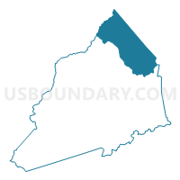
Outline

Summary
| Unique Area Identifier | 641483 |
| Name | Voting District BD |
| County | Transylvania County |
| State | North Carolina |
| Area (square miles) | 48.04 |
| Land Area (square miles) | 48.01 |
| Water Area (square miles) | 0.03 |
| % of Land Area | 99.93 |
| % of Water Area | 0.07 |
| Latitude of the Internal Point | 35.35846910 |
| Longtitude of the Internal Point | -82.70781280 |
Maps


Graphs
Select a template below for downloading or customizing gragh for Voting District BD, Transylvania County, North Carolina


Neighbors
Neighoring Voting District (by Name) Neighboring Voting District on the Map
- Voting District EF, Haywood County, NC
- Voting District ES, Henderson County, NC
- Voting District EV, Henderson County, NC
- Voting District LR, Transylvania County, NC
- Voting District NM, Henderson County, NC
- Voting District PF, Transylvania County, NC
- Voting District SM, Henderson County, NC
Top 10 Neighboring County Subdivision (by Population) Neighboring County Subdivision on the Map
- Mills River township, Henderson County, NC (13,470)
- Brevard township, Transylvania County, NC (11,623)
- Crab Creek township, Henderson County, NC (4,558)
- Boyd township, Transylvania County, NC (3,694)
- Little River township, Transylvania County, NC (2,545)
- East Fork township, Haywood County, NC (1,652)
Top 10 Neighboring Place (by Population) Neighboring Place on the Map
Top 10 Neighboring Unified School District (by Population) Neighboring Unified School District on the Map
- Henderson County Schools, NC (106,740)
- Haywood County Schools, NC (59,036)
- Transylvania County Schools, NC (33,090)
Top 10 Neighboring State Legislative District Lower Chamber (by Population) Neighboring State Legislative District Lower Chamber on the Map
- State House District 117, NC (85,227)
- State House District 113, NC (75,113)
- State House District 119, NC (73,640)
Top 10 Neighboring State Legislative District Upper Chamber (by Population) Neighboring State Legislative District Upper Chamber on the Map
Top 10 Neighboring 111th Congressional District (by Population) Neighboring 111th Congressional District on the Map
Top 10 Neighboring Census Tract (by Population) Neighboring Census Tract on the Map
- Census Tract 9605, Transylvania County, NC (5,710)
- Census Tract 9307.03, Henderson County, NC (5,578)
- Census Tract 9213.02, Haywood County, NC (5,431)
- Census Tract 9307.02, Henderson County, NC (4,506)
- Census Tract 9601, Transylvania County, NC (4,324)
- Census Tract 9604.01, Transylvania County, NC (4,127)
- Census Tract 9319.01, Henderson County, NC (3,503)
- Census Tract 9801, Henderson County, NC (0)
Top 10 Neighboring 5-Digit ZIP Code Tabulation Area (by Population) Neighboring 5-Digit ZIP Code Tabulation Area on the Map
- 28739, NC (19,786)
- 28716, NC (17,477)
- 28759, NC (6,922)
- 28768, NC (6,813)
- 28729, NC (2,894)
- 28742, NC (2,710)
- 28766, NC (1,262)
- 28708, NC (754)